
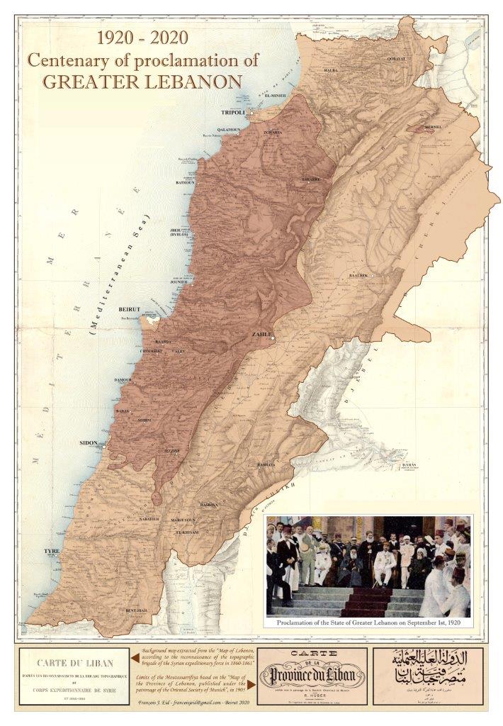
The map is based on historical maps dating from 1862 and 1905, shows the lebanon of Moutasassarrifiya and the borders of Greater Lebanon defined in the years following its declaration.

Ottoman Mount Lebanon

Rare Map of Ottoman Lebanon during World War I

Ottoman Map of Mount Lebanon and Surrounding Provinces, 1911

Carte du Liban, 1862

Carte géologique du Liban, 1926
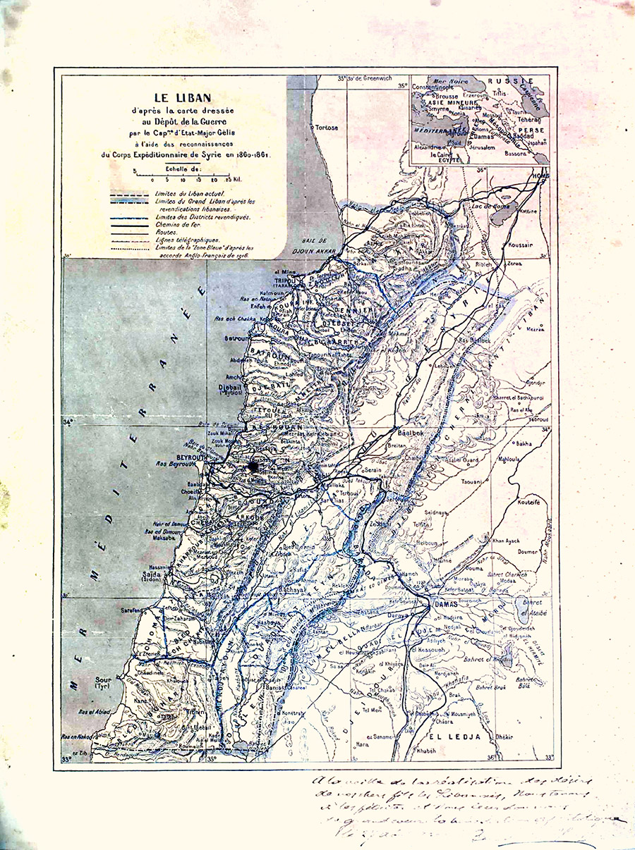
Carte du Le Liban, 1860-1861

خريطة جبل لبنان في العهد العثماني - أواخر القرن التاسع عشر.
